


The Indonesian Government’s Geospatial
Information Agency (BIG) announced the
winners of the Indonesian Peat
Prize on the World’s Wetlands Day yesterday.
The International
Peat Mapping Team, comprised of scientists from Remote Sensing Solutions GmbH (RSS),
the Agency for the Assessment and Application of Technology (BPPT) and
Sriwijaya University, is the winner of the US$1 million prize.
Led by the Indonesian government, the
Prize is supported by the David and Lucile Packard Foundation, a Scientific
Advisory Board (SAB) of peatland and mapping experts who served as judges, and
by a technical team that consists of the BIG, the Ministry of Agriculture and the
Ministry of Environment and Forestry (MoEF). World Resources Institute (WRI) Indonesia is the implementing
partner for the Prize.
Urgent
problem posed by draining and burning of peatlands
A WRI blog
explains that peatlands form when
dead plants partially decay in soils soaked with tannin-rich water, and organic
matter gradually accumulates in layers, over hundreds or even thousands of
years. Indonesia has around 36 percent of
the world’s tropical peatlands, which store up
to 20 times more carbon than non-peat mineral soils.
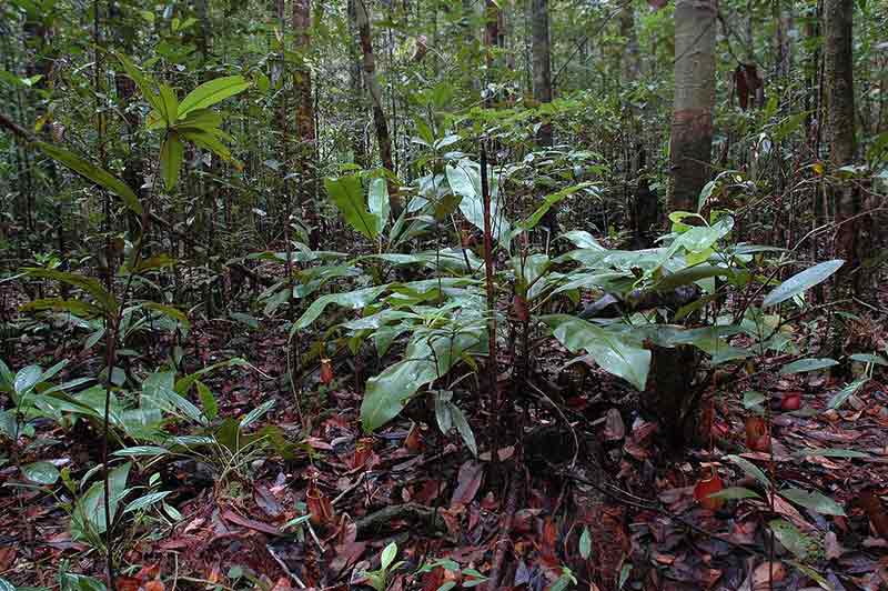
Peat “domes” are
complex hydrological formations that can range
in thickness from half a meter to more than 20 meters deep. Peatland
forests hold many times more carbon than a typical tropical forest, most of it
below ground and have rich biological diversity.
Peatlands are often drained or burnt for
agriculture and plantations. Once the above-ground natural vegetation is
cleared and the dome is drained, peat soils rapidly dry out and become highly
flammable. Land
fires that often engulf large areas of Sumatra,
Kalimantan, and most recently, Papua,
are concentrated in peatlands that have been converted to industrial oil palm
and timber plantations.
According to numbers from WRI, peatlands
were responsible for 42%
of Indonesia’s total emissions in 2015. In
the 2015 fire season, forests and peat fires were estimated by researchers from
Harvard University to have caused 100,000 premature deaths. They are also estimated to have cost the
Indonesian economy $16 billion, and released 1.62 billion metric tons of
greenhouse gas emissions, equivalent to the emissions produced by nearly
350,000 cars.
Inadequate current maps
The Indonesian Peat Prize was created by BIG in response to the lack of accurate and up-to-date information around peatlands in Indonesia. Current maps showing the location of the country’s peatlands are inaccurate, and don’t show the difference between shallow and deep peat. Depth information is important because the deeper the peat is, the more ecological damage, including carbon emissions, results from disturbance. This lack of information provides cover for companies to continue peatland conversion as usual. Better peatland maps would enable government agencies to better enforce laws and regulations. They would also help companies comply with zero-deforestation commitments, and NGO watchdogs to hold the government and corporates accountable.
The winning solution
The two-year contest sought to find
the best methodology to measure the extent and depth of peat in Indonesia. Forty-four
teams participated, including some of the biggest names in peat research and
mapping.
The methods proposed by the finalist teams included
a combination of established and innovative technologies, including airborne
remote sensing techniques such as laser altimetry, electromagnetic imaging and
radar interferometry as well as the ground measurement. There were strong
commonalities amongst methodologies proposed by the finalists and the final
decision was taken based on the criteria of accuracy, cost and speed
The SAB unanimously selected the International
Peat Mapping team’s solution. The Indonesian government will use this new
method to protect and manage peatland areas, accelerate peatland restoration
and support Indonesia’s development goals.
The International Peat Mapping Team
deployed satellite-based technologies and airborne LiDAR, combined with
established on-the-ground measurements.
The team used a product called WorldDEM
that uses satellite imagery to model terrain at a 10-meter resolution, along
with imagery from the Sentinel
satellites. These satellite-based technologies were then combined with
terrain models derived from airborne LiDAR (a technology that uses laser light
to create 3-D terrain maps).
The methodology also included well-established
on-the-ground measurements in order to create a model that could accurately
estimate peat thickness. Finally, the team verified the peat data resulting
from the combination of all these technologies with on-the-ground measurements.
The team included mapping and peatland experts from Indonesia, Germany and the
Netherlands: Prof. Dr. Florian Siegert, Dr. Uwe Ballhorn, Peter Navratil, Prof.
Dr. Hans Joosten, Dr. Muh. Bambang Prayitno, Dr. Bambang Setiadi, Felicitas von
Poncet, Suroso and Dr. Solichin Manuri.
Prof. Dr. Hasanuddin Z. Abidin, Head of BIG, said, “BIG is pleased
and excited that the Prize has produced the best method for mapping peatland
that combines accuracy, affordability and timeliness to support BIG’s work in
mapping and providing geospatial data and information. BIG will lead the
process of using the winning method as a reference to improve the current
standard for mapping peatland in a scale of 1:50,000, and will start the
process by issuing a BIG regulation on peatland mapping in a scale of 1:50,000.
By standardizing the method, we can have accurate peatland data and
information, which will protect our peatland in an effective and efficient way.”
Dr. Bambang Setiadi, an Indonesian
member of the International Peat Mapping team, said there is a clear evidence
that when groundwater level in a tropical peat swamp forest is low during dry
season, the peat will be more susceptible to fires. “This methodology will
support to acquire the topographic elevation data for peatland, including
dome-shaped peatland, which can be used to understand groundwater level and
other hydrological assessments for restoration purpose.”
“The winning method shows breakthrough
technology and a transparent way to map peatlands in the most accurate,
affordable and timely way. The Prize also represents international
collaboration and attention to meet the global challenge to limit global temperature
rise to less than 2 degrees Celsius,” said Dr. David Schimel,the SAB
co-chair and Senior Research Scientist at NASA Jet Propulsion Laboratory.
Supporting
Indonesian government’s peatland protection initiatives
The Peat Prize complements the
Indonesian government’s initiatives to protect peatland and maintain communities’
welfare. President Joko Widodo has made peatland management a priority in order
to achieve the country’s climate commitment under the Paris Agreement. The
Prize also supports the government’s One
Map Policy that seeks to consolidate spatial information on a common
platform.
The Government of Indonesia has
introduced a suite of initiatives designed to stop further peatland conversion
and restore some of the drained and denuded area. The Peatland Restoration
Agency was established in 2016 aiming to restore
2 million hectares (4.9 million acres) of peatlands within five years, and
President Joko Widodo issued a decree establishing a moratorium on further
commercial development of peatlands pending better mapping
and zoning. Subsequently, the Ministry of Environment and Forests came up with
a series of implementing regulations. Improved mapping would support the
enforcement of these regulations.
Prof. Dr. Supiandi Sabiham, the SAB co-chair and the Head of the
Indonesia’s Peatlands Association said, “The Scientific Advisory Board
appreciates the efforts of all finalists to develop the method to map and
protect peatlands, which are important for meeting Indonesia’s climate
commitments. Managing peatland sustainably and responsibly is thus critical,
and that’s where the Indonesian Peat Prize can play a huge role.”


