The Philippine government may have found a way to outsmart fire hazard disaster through the technology that they have funded.
According to a recent press release, Firecheck is a fire hazard mapping and fire spread modelling project that seeks to provide authority with information that can combat, if not mitigate, the negative consequences of fire.
What is Firecheck?
The project is funded by the Department of Science and Technology-Philippine Council for Industry, Energy and Emerging Technology Research and Development (DOST-PCIEERD) and implemented by the University of the Philippines, Cebu campus.
It aims to provide emergency fire responders and officials, strategic planners, and policy-makers with a plethora of information that they can use for fire disaster assessment and risk evaluation.
Firecheck’s hazard maps identify highly-dense residential areas in the cities that are prone to fire incidents, taking into consideration the construction material used in the area, the density of the building, and the urban heat of the island.
Mapping fire hazard is a critical step in acknowledging fire as an unavoidable disaster that must be contained, comparable to the preparation done for other disasters.
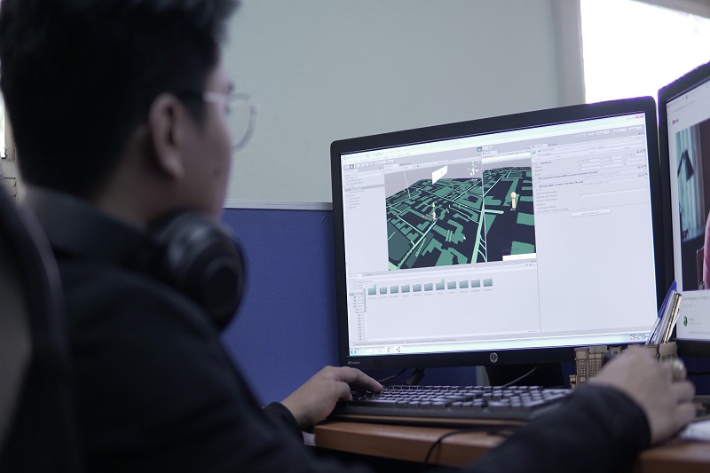
On top of the hazard maps, 3D maps of high-risk communities and fire spread models and simulation were created.
This was done to provide predictive information on the possible extent of the fire and its potential damage.
The maps, models and simulations can gather information that may be useful in improving pre-fire plans, evacuation plans, and investment plans for the fire-fighting facilities and mitigation plans.
Continuous Improvement
The team is currently working with the Disaster Risk Reduction and Management Office, City Planning and Development Office as well as the Bureau of Fire Protection (BFP) Regional Office 7.
They are working hand in hand to cover the cities of Cebu, Mandaue, and Lapu-Lapu, verifying the fire hazard maps they have created.
In addition, testing of the Firecheck Attribution App is also being done.
This mobile application can display the community’s 3D maps tagged with information necessary for pre-fire response planning such as building properties and road attributes.
It is currently undergoing modifications to improve its features after being tested in a pilot field survey done in Barangay Basak, Lapu-Lapu City.
The team will be training more users of the mobile app, developing evacuation plans, and validating the generated maps.
Road Ahead
Hopefully, Metro Cebu will not be the only beneficiary of this technology, but also the whole country. It is now high time to take a scientific and proactive approach to fire disasters.
There should be adequate preparation, prevention, and mitigation to guarantee that the fire will be put out even before it begins.
DOST-PCIEERD Executive Director Dr Enrico C. Paringit expressed confidence that the project will greatly benefit fire authorities in mitigating and controlling damage through the use of modern technology.
Firecheck will provide a smart solution in increasing the community’s resiliency against fire disasters.
The Department is looking forward to the day when Firecheck spreads across the nation and ignites the consciousness of the Filipino people in using technology to outsmart natural and man-made disasters.