Search
Close this search box.

We are creating some awesome events for you. Kindly bear with us.

Satellite Data to Bolster Singapore’s Environmental Research

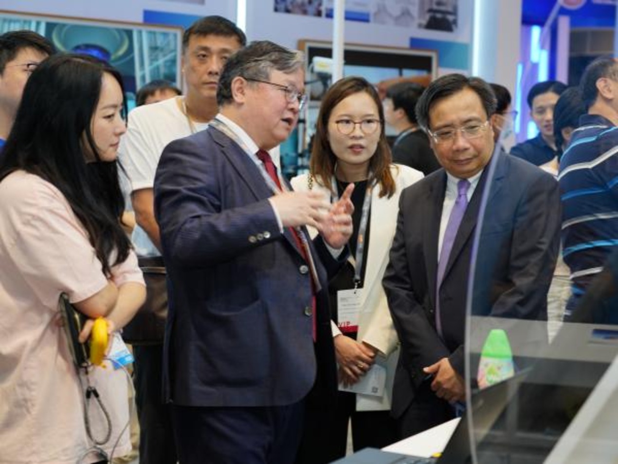
The Earth Observatory of Singapore (EOS) will lead the collaboration between the Nanyang Technological University (NTU Singapore) and Singapore Land Authority (SLA) in using Global Navigation Satellite System (GNSS) data for scientific studies.

The EOS, as the NTU Singapore Research Centre of Excellence, provides researchers with access to GNSS data collected by SLA’s Singapore Satellite Positioning Reference Network (SiReNT), as well as to its archived historical data.

Leveraging NTU’s strengths in areas such as sustainability and earth sciences, this collaboration also provides us with valuable data to contextualise more accurate projections to augment Singapore’s climate change response.

– Associate Professor Emma Hill, Acting Chair, Asian School of the Environment and Principal Investigator, Earth Observatory of Singapore

Hill ackownledged that Singapore’s GNSS data from the past is very important for understanding how the land and coast have changed over time. Using precise positioning technology like SLA’s SiReNT can help with more than just positioning and mapping. It can also open a lot of new ways to deal with the increasingly complicated problems caused by climate and environmental changes.

With the combined knowledge of SLA and EOS, they want to use the rich historical data to co-create solutions for a new era of predicting and preparing for coastal and land changes to help Singapore deal with and lessen the effects of climate change.

The collaboration between NTU and SLA supports the university’s NTU 2025 strategic plan, which aspires to address humanity’s great issues on sustainability and speed the translation of academic discoveries into solutions that lessen the human effect on the environment.

Together with EOS’s development of new coastal GNSS reference stations in Singapore, this will enable research into more accurate methods of measuring land height and sea-level changes around the country, as well as the effect of the atmosphere on the weather and climate on the island nation.

GNSS refers to various satellite navigation systems, including the well-known Global Positioning System (GPS), which can be used by systems such as SLA’s SiReNT to produce precise positioning data with a 3 cm accuracy.

The NTU-SLA agreement will establish four-year cooperation that will contribute to the Centre for Climate Research Singapore’s National Sea Level Programme (NSLP), which is supported by the National Research Foundation and the National Environment Agency.

Furthermore, during the duration of the collaboration, EOS will analyse previous GNSS data provided by SLA in order to determine how certain places’ land height has changed. This would increase the accuracy of elevation measurements generated from Interferometric Synthetic Aperture Radar (InSAR), the technique currently employed by NTU to map ground deformation over Singapore and other cities in the region.

In Singapore, EOS and SLA will deploy up to four additional coastal GNSS stations for data gathering to develop innovative approaches for monitoring both land height and sea-level changes. Additionally, they will be incorporated into the SiReNT infrastructure and services to maximise resource utilisation. Also, the existing SiReNT station data will be incorporated to assist this goal.

Simultaneously, EOS will study unique ways to use data from existing GNSS, such as investigating the amount of water vapour in the atmosphere. By characterising the atmospheric processes that impact Singapore at different timeframes, scientists may determine where and when localised weather systems are likely to cause heavy precipitation.

EOS researchers will also attempt to employ GNSS data in regional meteorological studies. By comparing and analysing GNSS and meteorological data in detail, the scientists hope to gain a deeper understanding of precipitation and extreme weather events.
PARTNER

Qlik’s vision is a data-literate world, where everyone can use data and analytics to improve decision-making and solve their most challenging problems. A private company, Qlik offers real-time data integration and analytics solutions, powered by Qlik Cloud, to close the gaps between data, insights and action. By transforming data into Active Intelligence, businesses can drive better decisions, improve revenue and profitability, and optimize customer relationships. Qlik serves more than 38,000 active customers in over 100 countries.

PARTNER

CTC Global Singapore, a premier end-to-end IT solutions provider, is a fully owned subsidiary of ITOCHU Techno-Solutions Corporation (CTC) and ITOCHU Corporation.

Since 1972, CTC has established itself as one of the country’s top IT solutions providers. With 50 years of experience, headed by an experienced management team and staffed by over 200 qualified IT professionals, we support organizations with integrated IT solutions expertise in Autonomous IT, Cyber Security, Digital Transformation, Enterprise Cloud Infrastructure, Workplace Modernization and Professional Services.

Well-known for our strengths in system integration and consultation, CTC Global proves to be the preferred IT outsourcing destination for organizations all over Singapore today.

PARTNER

Planview has one mission: to build the future of connected work. Our solutions enable organizations to connect the business from ideas to impact, empowering companies to accelerate the achievement of what matters most. Planview’s full spectrum of Portfolio Management and Work Management solutions creates an organizational focus on the strategic outcomes that matter and empowers teams to deliver their best work, no matter how they work. The comprehensive Planview platform and enterprise success model enables customers to deliver innovative, competitive products, services, and customer experiences. Headquartered in Austin, Texas, with locations around the world, Planview has more than 1,300 employees supporting 4,500 customers and 2.6 million users worldwide. For more information, visit www.planview.com.

SUPPORTING ORGANISATION

SIRIM is a premier industrial research and technology organisation in Malaysia, wholly-owned by the Minister​ of Finance Incorporated. With over forty years of experience and expertise, SIRIM is mandated as the machinery for research and technology development, and the national champion of quality. SIRIM has always played a major role in the development of the country’s private sector. By tapping into our expertise and knowledge base, we focus on developing new technologies and improvements in the manufacturing, technology and services sectors. We nurture Small Medium Enterprises (SME) growth with solutions for technology penetration and upgrading, making it an ideal technology partner for SMEs.

PARTNER

HashiCorp provides infrastructure automation software for multi-cloud environments, enabling enterprises to unlock a common cloud operating model to provision, secure, connect, and run any application on any infrastructure. HashiCorp tools allow organizations to deliver applications faster by helping enterprises transition from manual processes and ITIL practices to self-service automation and DevOps practices. 

PARTNER

IBM is a leading global hybrid cloud and AI, and business services provider. We help clients in more than 175 countries capitalize on insights from their data, streamline business processes, reduce costs and gain the competitive edge in their industries. Nearly 3,000 government and corporate entities in critical infrastructure areas such as financial services, telecommunications and healthcare rely on IBM’s hybrid cloud platform and Red Hat OpenShift to affect their digital transformations quickly, efficiently and securely. IBM’s breakthrough innovations in AI, quantum computing, industry-specific cloud solutions and business services deliver open and flexible options to our clients. All of this is backed by IBM’s legendary commitment to trust, transparency, responsibility, inclusivity and service.