Geography, sociology, philosophy students and staff at New Zealand’s Massey University will swap lecture theatres for the wilderness this summer.
About the Initiative
According to a recent press release, they will be using aerial and underwater drones for a film revealing land use, environmental issues and human-environment relationships in Aotearoa New Zealand.
The Spatial Awareness Project will also include underwater footage to create a comprehensive look at the breadth of natural and cultural landscapes at a time when the much-lauded landscape is under pressure.
Project leader Dr Cadey Korson, a Lecturer of Human Geography, is teaming up with Dr Alice Beban, a Sociologist, and Dr Krushil Watene, a Philosopher. They are colleagues in the College of Humanities and Social Sciences.
They are seeking help from public and private landowners for access to forests, grassland that includes tussock and pasture, cropland and wetland areas throughout the country.
The project will involve collecting aerial drone footage of the 12 different land-use types across New Zealand.
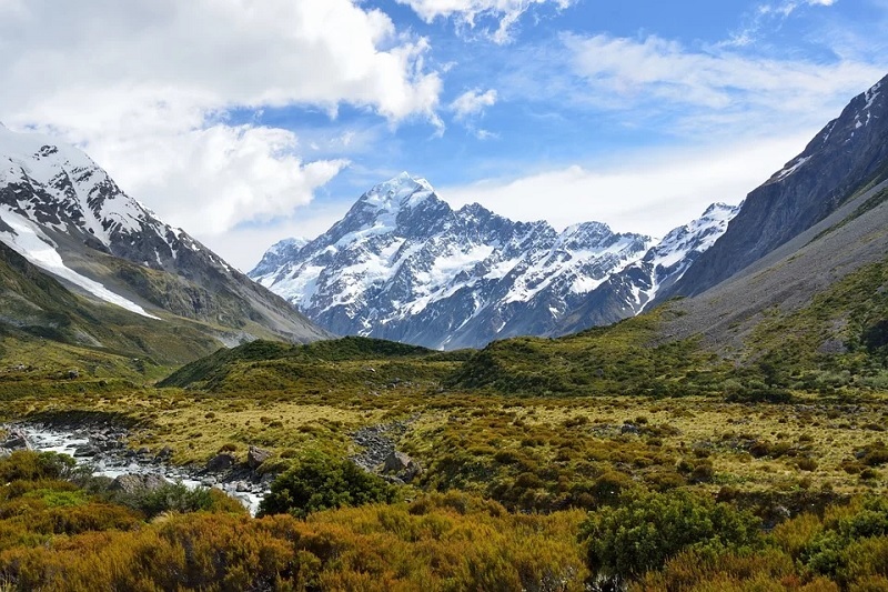
A few landowners and companies have already agreed to let them film. However, they still need a number of alternative locations to showcase the beauty of New Zealand and its unique landscapes.
One of the key aims of the project is to encourage the curiosity of students about the human impact on the environment and create a learning community where students are empowered to critically engage in debates about conservation and land use.
Background of the Initiative
Rapid urbanisation, intensifying natural hazards, climate change and exponential tourism growth are just a few of the catalysts that have an unassailable effect on natural and cultural landscapes.
The team aims to create a three-minute short film and a series of complimentary podcasts that will include interviews with industry partners, kaitiaki, landowners, environmental managers and community members.
They will be asked about corresponding natural resource management issues and different ways of understanding and valuing the natural world.
Hopefully, this project will demonstrate to Bachelor of Arts students the exciting possibilities and enrichment these new Geographic Information System (GIS) technologies are bringing to the study of geography, and the potential job opportunities for students who are learning how to use it.
How it will Work
The summer drone filming involves one to two hours of the team flying the Mavic 2 Pro about 75-100 meters over the plot of land.
Landowners will receive a copy of the unedited aerial footage and be provided a link to the final video on YouTube.
Filming begins mid-January in the South Island for a month, then the central and southern North Island in February and Northland in March.
Dr Korson wants to hear from anyone with access to sites across the country to be included in the project, including forest, grassland, cropland, wetland and settlements.