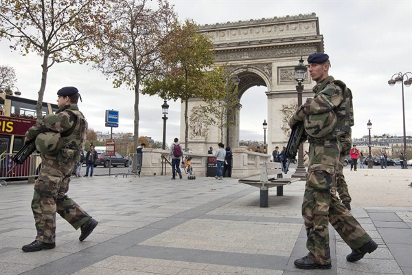
This past week, our world was rocked by the Paris terror attacks which claimed the lives of 129 people of various nationalities. A whole city was brought to a stand still and many people across the world mourned with France. As the Islamic State militant threat seems to increase globally, we can’t help but consider what solutions may help our defense against them.
The Islamic State, also referred to as Daesh, is getting smarter. Unfortunately, the group is also increasing in numbers and claimed territory. They are frequently using connected devices to communicate, as any other person would. However, many operatives are able to communicate in true secrecy. This fact may frighten a lot of governments.
ISIS operatives are known to use encryption tools to prevent outsiders from tracking or deciphering conversations being carried out through digital means. This means that government intelligence networks cannot trace them or anticipate their actions. This is highly dangerous as we do not want our recent history repeating itself.
Geospatial intelligence must be capitalized to thwart these attackers and their plans to strike terror. Geospatial tools, including mapping, satellite imagery, GPS, various analyses, community mapping, and big data analytics, are especially useful in preparing a solid defense.
As Robert Cardillo, director of the US National Geospatial-Intelligence Agency emphasised to the press, “They are learning…to plan and to execute these heinous attacks in ways that stay under our ability to detect them…We must create new signatures, we must create a new sense of awareness.”
Mr. Cardillo is considered to be a top US intelligence official speaking on such matters. His agency is responsible for delivering first-class intelligence via geospatial tools and technology.
Their intelligence is often renowned for its accuracy and advanced geospatial intelligence (GEOINT). GEOINT allows the exploitation and analysis of imagery and geospatial data which describes, assesses and visually depicts physical features and geographically referenced activities, globally. The agency is world renowned for its work with policymakers, war fighters, intelligence professionals and first responders.
In the wake of the Paris terrorist bombings and shootings, it has been made clear that every country must be on high alert. Using advanced geospatial tools will thus create an enhanced network of global transparency .
In explaining the effect of geospatial intelligence, Cardillo explained, “Broad-based applications so that you can find a convenient cup of coffee without a lot of traffic are the same kinds of technology that I can use to help advise that medical official where should I put that treatment unit to create the greatest effect.”
Geospatial data can detect bimodal spatial patterns of terrorist preparation bimodal spatial pattern of both, preparation processes and target selection.. With this data being made available in real-time, governments can react rapidly and with efficiency. All governments must consider geospatial intelligence as a primary tactic to detecting these terror networks and suspicious congregations.