
- Like
- Digg
- Del
- Tumblr
- VKontakte
- Flattr
- Buffer
- Love This
- Odnoklassniki
- Meneame
- Blogger
- Amazon
- Yahoo Mail
- Gmail
- AOL
- Newsvine
- HackerNews
- Evernote
- MySpace
- Mail.ru
- Viadeo
- Line
- Comments
- Yummly
- SMS
- Viber
- Telegram
- Subscribe
- Skype
- Facebook Messenger
- Kakao
- LiveJournal
- Yammer
- Edgar
- Fintel
- Mix
- Instapaper
- Copy Link
In an increasingly digitalised world, data and information are not only foundational and catalytic but fuel that drives almost everything. But more than just volumes of raw data and mountains of basic information, what is required for actionable, intelligent insights is the understanding of the complex relationships between data points and their nuanced correlations.
As organisations across the public and private sectors become increasingly reliant on AI tools and platforms for decision-making, knowledge graphs take on more significance. They offer a comprehensive way to represent data relationships and derive meaning. Knowledge graphs embed intelligence into the data itself and offer AI the tools to make sense of it all – to be more explainable, accurate and repeatable.
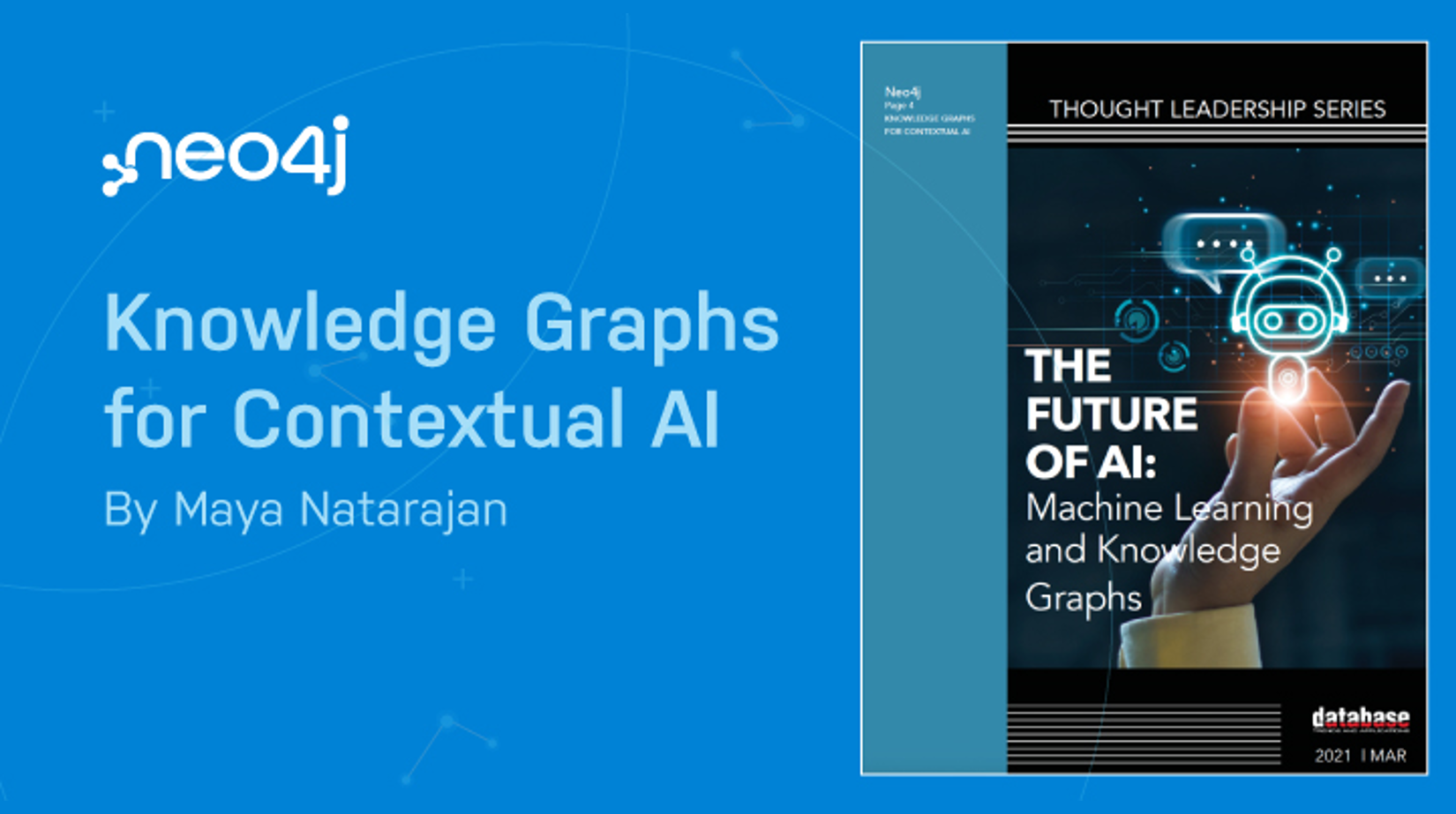
THE FUTURE OF AI: Machine Learning and Knowledge Graphs is a great read for forward-thinking organisations that are keenly aware of the power their data represents and who understand that its proper use empowers intelligent decision making.
Read more to gain a better understanding of the power of knowledge graphs that can vastly improve decision-making and impact business performance and outcomes.

- Like
- Digg
- Del
- Tumblr
- VKontakte
- Flattr
- Buffer
- Love This
- Odnoklassniki
- Meneame
- Blogger
- Amazon
- Yahoo Mail
- Gmail
- AOL
- Newsvine
- HackerNews
- Evernote
- MySpace
- Mail.ru
- Viadeo
- Line
- Comments
- Yummly
- SMS
- Viber
- Telegram
- Subscribe
- Skype
- Facebook Messenger
- Kakao
- LiveJournal
- Yammer
- Edgar
- Fintel
- Mix
- Instapaper
- Copy Link
The Philippine Space Agency has begun its pre-implementation of a new project to capacitate and enable various sectors to access and use space data in accordance with their needs. The PhilSA Space Information Infrastructure Bureau will carry out the PINAS project, which stands for PhilSA Integrated Network for Space-Enabled Actions Toward Sustainability (SIIB).
PINAS will be an active community of national government agencies, local government units (LGU), research institutions, the civil society, and the private sector, working collaboratively on the socially responsive use of space data and information.
– Dr Ariel C. Blanco, Director, Space Information Infrastructure Bureau
Dr Blanco continued by saying that the PINAS project aims to empower a community by utilising the entire value chain of space data. The significance of space data collected by satellites for planning, monitoring, and local policymaking was underlined.
Dr Ariel emphasised that working together with LGUs, who are direct users of satellite data, will improve on-ground operations even more. Network development, capacity development, and build-up and growth will be the three phases of PINAS. The network building phase has been launched by the SIIB, starting with the Province of Iloilo.
In Dumangas, Iloilo, the Department of Science and Technology-Advanced Science and Technology Institute (DOST-ASTI) runs and maintains the third Ground Receiving Station (GRS) in the nation. Over 100 representatives from the province’s LGUs, regional government agencies, and non-government organisations attended the PINAS Project’s pre-implementation workshop.
Participants come from different sectors involved in agriculture, disaster risk reduction management (DRRM), urban and rural planning, environmental monitoring, and natural resource management – all areas where space data could be useful for data-driven policymaking. PhilSA’s goal is to create a community of diverse, responsive, and cooperative members who will ensure long-term knowledge sharing across the country using space products.
The space agency also gave a presentation on the applications of remote sensing and geographic information systems (RS-GIS). This provided an overview of RS-GIS and how information from these images is used for land cover change detection, flood mapping, monitoring of ocean and marine ecosystems, and air quality monitoring efforts, to name a few.
UPV also uses space science and technology applications to detect changes in the environment. One example is studying the enhanced vegetation index over time to detect topographical changes on the UPV Miagao Campus.
Some workshops were also provided, and the participants had the opportunity to identify the problems and challenges that their sectors are facing, as well as the efforts and plan to address those challenges, as well as sites of interest and opportunities for capacity building and networking.
During the workshops, participants were also asked to conduct a baseline survey to assess LGUs’ positions and capabilities in space-related programmes and projects, the use of space data products, ICT infrastructure and human resources, resource allotment, and learning opportunities.
Similar workshops will be conducted in other parts of the Philippines as part of the programme to determine their requirements and talents. Based on these requirements, PhilSA would be able to cooperatively construct a unique capacity-building method and ultimately enable end-users to establish a system for space data access, sharing, and utilisation -this would enable them to fulfil their responsibilities and address the needs of the communities.
Capacity-building activities will begin in 2023. In addition, the establishment of a network data-sharing system and the expansion of this system to other local government entities, research communities, and segments of the civil society will occur soon.
- Like
- Digg
- Del
- Tumblr
- VKontakte
- Flattr
- Buffer
- Love This
- Odnoklassniki
- Meneame
- Blogger
- Amazon
- Yahoo Mail
- Gmail
- AOL
- Newsvine
- HackerNews
- Evernote
- MySpace
- Mail.ru
- Viadeo
- Line
- Comments
- Yummly
- SMS
- Viber
- Telegram
- Subscribe
- Skype
- Facebook Messenger
- Kakao
- LiveJournal
- Yammer
- Edgar
- Fintel
- Mix
- Instapaper
- Copy Link
The Advanced Science and Technology Institute (ASTI) an agency under the Department of Science and Technology (DOST), has establishing its second LokaLTE Base Station in Looc Integrated School, Castillejos, Zambales. Project REIINN, or Resilient Education Information Infrastructure for the New Normal, is a project that focuses on the creation of application frameworks and infrastructures to enable the shift to remote learning and close the digital gap in the Philippines.
“In a nutshell, the LokaLTE component focuses on the local development and deployment of community LTE networks in the Philippines. Meanwhile, the RuralCasting component exploits the use of data broadcasting mechanisms in distributing educational resource materials in remote communities,” said Franz de Leon, Director, DOST-ASTI.
The LokaLTE Base Tower is one of the Philippines’ national government’s efforts to bridge the country’s digital divide. This tower will provide Internet connectivity and will aid in the continuity of learning in the Zambales community.
Project REIINN is funded by the Philippine Council for Industry, Energy, and Emerging Technology Research and Development (PCIEERD) and includes two initiatives: LokaLTE and RuralCasting.
The initiative is just the start of the project’s long-term goals, which include connecting everyone and making it easier for policies on spectrum management and community networks to be adopted.
It is anticipated that Project REIINN will reduce teachers’ difficulties, particularly in terms of communication between students and their parents – it can explore other avenues for the advancement of children.
In addition, the first LokaLTE Base Station was erected in Tanay, Rizal in May 2022. DOST-ASTI began Project REIINN in 2021 with the belief that access to the internet and information in unserved and underserved areas will become the norm because of technological interventions and appropriate policies.
The creation and deployment of small-scale, community-operated LokaLTE towers is one of the project’s objectives. This initiative is anticipated to have more groundbreakings in unserved and underserved regions in the Philippines until all students, regardless of location, have equal access to digital learning and reap the same benefits.
DOST-ASTI Strengthens the SARwAIS Project
Researchers from DOST-DATOS ASTI’s and Synthetic Aperture Radar and Automatic Identification System for Innovative Terrestrial Monitoring and Maritime Surveillance (SARwAIS) Project conducted an Introduction to Radar Remote Sensing training series in order to broaden the use of Remote Sensing in processing earth observation data and automating the detection of features from SAR satellite images.
The training was designed to further grow what DOST-ASTI has started in the race for space technology, and it was planned to do so with the normal backing from the Philippine Space Agency. In addition, the training was intended to acquaint the partner agencies, and the security sector, with the utilisation of SAR data to supplement their mission and efforts, particularly in marine domain awareness and resource monitoring.
Participants were informed, with a particular emphasis on the utilisation of SAR data, of the ways in which the available satellite resources (NovaSAR, Sentinel-1, and ICEYE) could potentially assist in the monitoring and asset deployment initiatives that they are engaged in. The programme lasted for four days and was filled to the brim with lectures and hands-on exercises that further armed them with abilities in remote sensing and GIS, which in turn enhanced their awareness of geospatial concepts.
Representatives from each agency presented their results at the conclusion of the training course, debating at length how to utilise this information in their individual offices. Participants also toured the DOST-ASTI facilities to examine infrastructures such as the ground receiving station and data centre.
- Like
- Digg
- Del
- Tumblr
- VKontakte
- Flattr
- Buffer
- Love This
- Odnoklassniki
- Meneame
- Blogger
- Amazon
- Yahoo Mail
- Gmail
- AOL
- Newsvine
- HackerNews
- Evernote
- MySpace
- Mail.ru
- Viadeo
- Line
- Comments
- Yummly
- SMS
- Viber
- Telegram
- Subscribe
- Skype
- Facebook Messenger
- Kakao
- LiveJournal
- Yammer
- Edgar
- Fintel
- Mix
- Instapaper
- Copy Link
The Monetary Authority of Singapore (MAS) together with the International Finance Corporation (IFC) and the United Nations Development Programme (UNDP) has launched an open financial education and action initiative tag as SME Financial Empowerment (SFE) for micro, small and medium enterprises (MSMEs) in Asia and Africa.
To help MSMEs thrive in the post-pandemic digital economy, the SFE intends to help them establish their core digital financial literacy skills and gain a good understanding of cross-border financial services relevant to MSMEs. The programme was launched in collaboration with market partners in Asia and Africa, beginning with Ghana, India, the Philippines, and Singapore, and will benefit over 400,000 MSMEs in these regions.
An empowered MSME is essential to an equitable and sustainable digital economy. Such enablement begins with digital economy literacy.
– Sopnendu Mohanty, Chief FinTech Officer, Monetary Authority of Singapore
The affordable, bite-sized learning programme offered by SFE, he added, is the result of a collaborative effort between financial institutions and the public and private sectors. Through the foundational and global financial literacy programmes, micro, small, and medium-sized enterprises (MSMEs) in Asia and Africa will gain new abilities to utilise networks, financial, and digital resources to expand their businesses abroad.
SFE is a global platform that connects domestic SME ecosystems and catalyses cross-border trade, financing, and digital services. It is an inclusive and organised programme that is conducted on a web portal.
Furthermore, the UN Capital Development Fund (UNCDF), Singapore University of Social Sciences (SUSS), and the Global FinTech Institute (GFI) are among the other important supporters of the SFE. The SFE’s goal for 2022 is to help MSMEs in three areas: essential financial digital skillsets, MSME financial services, and digital economy access and growth.
The first phase of the programme will consist of two learning modules that will focus on essential financial digital skillsets such as (a) Foundational Financial Literacy, which will cover basic financial concepts and financial products important to MSMEs; and (b) Global Financial Literacy, which will prepare MSMEs to connect to the digital economy and expand internationally by leveraging networks, financial services, fintech solutions, and digital tools.
Additional learning modules will be offered in subsequent instalments. Businesses will obtain a digitally verifiable certificate from SUSS and GFI upon completion of each module, granting access to financial services tools and information services via a resource portal.
Meanwhile, the SFE builds on a previous Memorandum of Understanding (MOU) between MAS and IFC on the Financial Trust Corridor (FTC) initiative, which aims to promote greater financial knowledge sharing, financial trust, and financial inclusion for MSMEs and financial institutions in developing countries.
The FTC consists of a multi-party cross-border governance framework and trusted closed-loop digital infrastructure that governments and financial institutions from various countries can use to share verified information on foreign business counterparties and the financial institutions that support them. This information will facilitate funding access for companies engaged in international trade.
In many nations, SMEs account for up to 90 per cent of the business segment and up to 80 per cent of employment. However, the potential of SMEs is frequently hampered by knowledge gaps regarding digital processes and technologies. Through suitable training and digital finance skills, assisting SMEs to engage in the digital economy can generate productive and sustainable growth potential.
- Like
- Digg
- Del
- Tumblr
- VKontakte
- Flattr
- Buffer
- Love This
- Odnoklassniki
- Meneame
- Blogger
- Amazon
- Yahoo Mail
- Gmail
- AOL
- Newsvine
- HackerNews
- Evernote
- MySpace
- Mail.ru
- Viadeo
- Line
- Comments
- Yummly
- SMS
- Viber
- Telegram
- Subscribe
- Skype
- Facebook Messenger
- Kakao
- LiveJournal
- Yammer
- Edgar
- Fintel
- Mix
- Instapaper
- Copy Link
Dr Gay Jane P. Perez, Deputy Director-General for Space Science and Technology at the Philippine Space Agency addresses the country’s growing vulnerability to climate change using space data collected by the agency’s sovereign satellites, curated satellite data sources, ground stations, and high-performance computing systems. She added that data is readily accessible, and the technical capacity to house this data exists, but the issue lies in translating this data into useful insights.
To realise the economic value, we must maximise what we can get from space data, such as maps, forecasts, and advisories that serve as an impetus to actionable insights that benefit our end-users, such as our fishermen or farmers.
– Dr Gay Jane P. Perez, Deputy Director-General, Space Science and Technology, Philippine Space Agency
An important part of space data mobilisation is a needs assessment, which is being done right now through the 2021–2030 Decadal Survey. This survey has brought together scientists and people from the public and private sectors in the country to identify the most important challenges and goals in Earth observation and other satellite applications for the next ten years.
The results of the Decadal Survey will be used to figure out what the most important and urgent problems in the country are and what the most important and urgent space missions should be. The survey focuses on six categories, including :
- Hydrologic Cycles and Climate Studies
- Weather, Air Quality, and Atmospheric Processes
- Earth Surface and Interior: Dynamics and Processes
- Hazards and Disaster Risk, Reduction, and Management
- Aquatic Ecosystems and Water Resources Management
- Terrestrial Ecosystems and Land Resources Management
Furthermore, PhilSa produces programmes that directly improve the capability to utilise Earth Observation data by analysing the requirements and existing capabilities.
ISKUELA, or Inclusive SSTA Know-how Utilisation, Exchange, and Localisation Activities is one of the activities that PhilSA has implemented to utilise and cascade EO data. ISKUELA is comprised of numerous initiatives and activities designed to educate and strengthen the capacity of partners from academia, industry, media, communities, and the public sector on how to use space data for their purposes.
The Space Information Infrastructure Capacity Building and Training Programme is one of these projects, with the goal of increasing awareness and understanding of space information infrastructures and their applications through webinars, short courses or even resource person support. The project has successfully held two webinars, with students, researchers, and representatives from various local government units participating.
PhilSA also hosts maps derived from space data via the Space Data Dashboard, which was developed collaboratively by PhilSA, DOST-ASTI, and the STAMINA4Space Programme. The dashboard includes publicly available satellite data maps of ship traffic, air quality, water quality, and night lights.
The agency hosts an annual Space Data Dashboard Media Workshop to help the public understand these open maps. Journalists are taught to navigate and produce articles using space data. PhilSA hopes to expand the workshop to include training for campus journalists.
It has been realised that there are still gaps in how space data is used to act on climate change. One way to close this gap is to improve how space science is taught and communicated. It is also important to reach out to a wide range of people and groups to show how using information from space to deal with uncertainties in the environment can be helpful.
- Like
- Digg
- Del
- Tumblr
- VKontakte
- Flattr
- Buffer
- Love This
- Odnoklassniki
- Meneame
- Blogger
- Amazon
- Yahoo Mail
- Gmail
- AOL
- Newsvine
- HackerNews
- Evernote
- MySpace
- Mail.ru
- Viadeo
- Line
- Comments
- Yummly
- SMS
- Viber
- Telegram
- Subscribe
- Skype
- Facebook Messenger
- Kakao
- LiveJournal
- Yammer
- Edgar
- Fintel
- Mix
- Instapaper
- Copy Link
The Department of Science and Technology (DOST) of the Philippines is now hiring more researchers, scientists, and engineers to assist the government and industry in making and implementing more science-based decisions and policies.
COVID-19 established the need for Science and Technology (S&T) Fellows, but the Philippines had been using science, technology, and innovation as decision-making inputs prior to the global health epidemic, according to Rowena Cristina L. Guevara, Undersecretary, DOST.
Recognising the potential threats humanity may face in the next years, the DOST deemed it vital to implement strategic measures that would ensure a stable and sustainable supply of Filipino researchers, scientists, and engineers. Guevara indicated that the DOST research and development (R&D) section will be manned by master’s and doctoral degree holders on a five-year contract in the context of the DOST S&T Fellows programme.
It has been over a year since the concept of increasing DOST agencies’ workforces with MS and PhD graduates from various S&T specialisations became a reality. To commemorate this momentous occasion, DOST hosted its first S&T Fellows Convention. DOST cited that it is in the hearts of Filipino scientists to share their knowledge and experience with the country, regardless of the money offered.
In the meantime, this initiative is not new in nations that strive to be leaders in technological growth and advancement overall. Around 51,000 students are receiving financial assistance from the DOST through the Science Education Institute (SEI), which administers all scholarship programmes at the undergraduate and graduate levels. In the meantime, the department of science has 4,308 students enrolled in graduate programmes and 1,550 students working on their PhD.
In its hunt for outstanding individuals with backgrounds in science and technology from all over the world, the DOST is seeking to find academics like these. There is now a total of 32 S&T Fellows whose services are being utilised by various departments and agencies within the DOST. In general, the S&T fellows programme offers researchers, scientists, and engineers the chance to participate in important work within the country while also receiving income that is on par with other similar programmes.
There is more to the work that the S&T Fellows conduct than simply the results and outcomes of research and development. They put in a lot of hours working in laboratories, coming up with ideas for road plans, analysing materials, and conducting experiments; the results of their effort will be beneficial to hundreds of thousands, if not millions, of Filipinos. Furthermore, the National Academy of Science and Technology of the Philippines (NAST PHL) recently held the Grand Launching of PAGTANAW 2050.
DOST is optimistic about the institutionalisation of PAGTANAW 2050, as it is a long-term policy instrument that requires regular review and updating to remain relevant to the times. Aside from its review, there is also a need to continuously fund the initiative, which extends beyond term limits and administrative appointments.
The initiative is a significant step toward designing and implementing integrated yet time-specific strategies for a prosperous, inclusive, and agile Philippine future in which the shared vision of the Philippines as a Prosperous, Archipelagic, and Maritime Nation can only be realised by diplomatically asserting rights over marine resources.
The foresight will provide clearer direction on developing enabling mechanisms to further accelerate scientific growth and innovation that will serve the nation’s interests and benefit the Filipino people.
- Like
- Digg
- Del
- Tumblr
- VKontakte
- Flattr
- Buffer
- Love This
- Odnoklassniki
- Meneame
- Blogger
- Amazon
- Yahoo Mail
- Gmail
- AOL
- Newsvine
- HackerNews
- Evernote
- MySpace
- Mail.ru
- Viadeo
- Line
- Comments
- Yummly
- SMS
- Viber
- Telegram
- Subscribe
- Skype
- Facebook Messenger
- Kakao
- LiveJournal
- Yammer
- Edgar
- Fintel
- Mix
- Instapaper
- Copy Link
Nanyang Technological University, Singapore (NTU, Singapore) climate scientists have extended the known record of Singapore’s sea level to almost 10,000 years ago, giving a more solid dataset to improve future sea-level rise projections.
This more refined sea-level record also has wider implications. For instance, it would lead to more robust and accurate local projection of sea-level rise, offering a strategic guide for Singapore as it moves to adapt to climate change.
– Dr Stephen Chua, Lead Author
Stephen added by dating the Singapore sea-level record to 10,000 years ago, they retrieved crucial new information from the early Holocene period. This is a time of rapid sea-level rise that has remained poorly understood – until now. Furthermore, reconstructing its history over thousands of years is one of the most difficult aspects of studying climate change. To have a better understanding of the possible causes and repercussions of future developments, scientists must study and comprehend the past.
An international team led by NTU researchers extracted ancient sediments from up to 40 m underground at a site in Singapore’s Marina South. The samples were then subjected to rigorous laboratory methods such as identifying microfossils like foraminifera and statistical analysis to reconstruct Singapore’s sea-level history.
The longer the sea-level record goes back in time, the clearer the picture becomes for future predictions, according to climate scientists. The Holocene transition (10,000-7,000 years ago) was the last major episode of natural global warming in Earth’s history, with melting ice sheets and rising oceans resulting in a 20-meter rise in sea level. Before the recent increase in the twentieth century due to climate change, the sea level in Singapore has been constant for the last 3,000 years.
Researchers believed that this is the type of crucial information needed to effectively plan adaptation measures in the face of ongoing sea-level rise due to global warming. The team chose the Marina South investigations. Sediment extraction from an ‘ideal’ site with deposits like marine mud and mangrove peats was required to create an accurate ancient sea-level record.
Sea-level rise is a potentially disastrous outcome of climate change, as rising temperatures melt ice sheets and warm ocean waters. Scenarios of future rise are dependent upon understanding the response of sea level to climate changes. Accurate estimates of past sea-level variability in Singapore provide a context for such projections.
– Professor Benjamin Horton, Co-author & Director, Earth Observatory of Singapore
Singapore’s coastal defence plan against rising sea levels will benefit from the findings. The study also discovered the first clear evidence that mangroves only existed for roughly 300 years in the Marina South area before succumbing to flooding caused by rising sea levels at the time.
Researchers discovered abundant mangrove pollen at a depth of 20 metres below contemporary sea level, indicating that a mangrove shoreline existed in southern Singapore nearly 10,000 years ago. According to the findings of the NTU, sea-level rise during that time was as much as 10 – 15 mm per year, which likely contributed to the extinction of the mangrove.
The findings are useful for present and future adaptation strategies in Singapore, as the island nation seeks to move beyond engineering solutions and use natural approaches to protect its shoreline.
Despite their adaptability and usefulness as coastal defence, mangroves have limitations in the event of a fast sea-level rise, according to the study. This research backs up a previous study co-authored by NTU that found mangroves will perish if sea levels rise faster than 7 mm per year under a high carbon emissions scenario.
The sea-level change was modelled without deglaciation, meltwater discharge, and other considerations. This important systematic contribution from Singapore and the vicinity spans the post-glacial Holocene period, allowing a broad sea-level change pattern to be formed.
- Like
- Digg
- Del
- Tumblr
- VKontakte
- Flattr
- Buffer
- Love This
- Odnoklassniki
- Meneame
- Blogger
- Amazon
- Yahoo Mail
- Gmail
- AOL
- Newsvine
- HackerNews
- Evernote
- MySpace
- Mail.ru
- Viadeo
- Line
- Comments
- Yummly
- SMS
- Viber
- Telegram
- Subscribe
- Skype
- Facebook Messenger
- Kakao
- LiveJournal
- Yammer
- Edgar
- Fintel
- Mix
- Instapaper
- Copy Link
The Earth Observatory of Singapore (EOS) will lead the collaboration between the Nanyang Technological University (NTU Singapore) and Singapore Land Authority (SLA) in using Global Navigation Satellite System (GNSS) data for scientific studies.
The EOS, as the NTU Singapore Research Centre of Excellence, provides researchers with access to GNSS data collected by SLA’s Singapore Satellite Positioning Reference Network (SiReNT), as well as to its archived historical data.
Leveraging NTU’s strengths in areas such as sustainability and earth sciences, this collaboration also provides us with valuable data to contextualise more accurate projections to augment Singapore’s climate change response.
– Associate Professor Emma Hill, Acting Chair, Asian School of the Environment and Principal Investigator, Earth Observatory of Singapore
Hill ackownledged that Singapore’s GNSS data from the past is very important for understanding how the land and coast have changed over time. Using precise positioning technology like SLA’s SiReNT can help with more than just positioning and mapping. It can also open a lot of new ways to deal with the increasingly complicated problems caused by climate and environmental changes.
With the combined knowledge of SLA and EOS, they want to use the rich historical data to co-create solutions for a new era of predicting and preparing for coastal and land changes to help Singapore deal with and lessen the effects of climate change.
The collaboration between NTU and SLA supports the university’s NTU 2025 strategic plan, which aspires to address humanity’s great issues on sustainability and speed the translation of academic discoveries into solutions that lessen the human effect on the environment.
Together with EOS’s development of new coastal GNSS reference stations in Singapore, this will enable research into more accurate methods of measuring land height and sea-level changes around the country, as well as the effect of the atmosphere on the weather and climate on the island nation.
GNSS refers to various satellite navigation systems, including the well-known Global Positioning System (GPS), which can be used by systems such as SLA’s SiReNT to produce precise positioning data with a 3 cm accuracy.
The NTU-SLA agreement will establish four-year cooperation that will contribute to the Centre for Climate Research Singapore’s National Sea Level Programme (NSLP), which is supported by the National Research Foundation and the National Environment Agency.
Furthermore, during the duration of the collaboration, EOS will analyse previous GNSS data provided by SLA in order to determine how certain places’ land height has changed. This would increase the accuracy of elevation measurements generated from Interferometric Synthetic Aperture Radar (InSAR), the technique currently employed by NTU to map ground deformation over Singapore and other cities in the region.
In Singapore, EOS and SLA will deploy up to four additional coastal GNSS stations for data gathering to develop innovative approaches for monitoring both land height and sea-level changes. Additionally, they will be incorporated into the SiReNT infrastructure and services to maximise resource utilisation. Also, the existing SiReNT station data will be incorporated to assist this goal.
Simultaneously, EOS will study unique ways to use data from existing GNSS, such as investigating the amount of water vapour in the atmosphere. By characterising the atmospheric processes that impact Singapore at different timeframes, scientists may determine where and when localised weather systems are likely to cause heavy precipitation.
EOS researchers will also attempt to employ GNSS data in regional meteorological studies. By comparing and analysing GNSS and meteorological data in detail, the scientists hope to gain a deeper understanding of precipitation and extreme weather events.