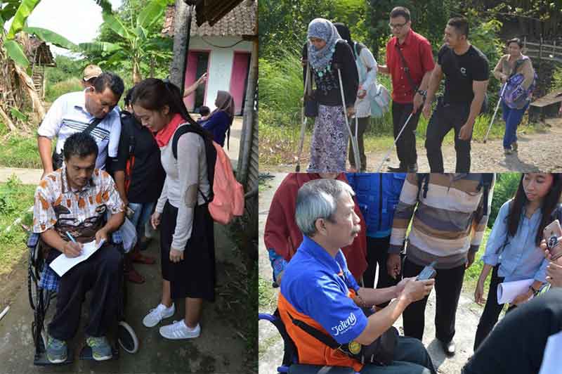
Image: Training disabled communities from 8 provinces, April 2017 (Credit: HOTOSM Indonesia Twitter Page)
Some of the most vulnerable communities in the world do not exist on any map. They are literally invisible. They are the ones to bear the brunt of disasters and diseases. In the aftermath, relief efforts are unable to reach them.
The Humanitarian OpenStreetMap Team (HOT), a US-based non-profit organisation, trains and equips people to map their communities, to make visible the places where they live.
Working with a global community of thousands of volunteers, HOT leverages technology and applies the principles of open source and open data sharing to create maps vital for humanitarian response and economic development. Its global partners include American Red Cross, the Bill & Melinda Gates Foundation, the US Department of State, Peace Corps, the World Bank and more.

HOT has been present in Indonesia since 2011. OpenGov spoke to Mr. Yantisa Akhadi about HOT’s activities in Indonesia and how the organisation is working with national and local disaster management agencies. Mr. Akhadi joined the HOT team in 2013 as the project lead. Currently, he manages the HOT Indonesia team and its projects.
Ongoing projects
HOT Indonesia had two major ongoing projects. The first one is to strengthen the capacity of the Indonesian National Board for Disaster Management (Badan Nasional Penanggulangan Bencana or BNPB). BNPB considers 136 districts or cities to be disaster-prone districts. They are considered to be at high risk for multiple types of disasters. The goal is to have maps for all 136 of these districts, before disaster strikes, to have enough data and use it for better response.
This project is funded by the Department of Foreign Affairs and Trade (DFAT), Australia Initially it was AUSAID, but AUSAID was dissolved and merged back into DFAT. Now it is under DMInnovation (Disaster Management Innovation). DMI is managed by the Australian embassy in Indonesia and is responsible for scientific implementation and exploring how science can help decision-makers during disaster management.

In the second project , HOT is collaborating on a USAID, Office of U.S. Foreign Disaster Assistance (OFDA) funded programme together with the University of Hawaii: Pacific Disaster Centre (PDC) and the Massachusetts Institute of Technology (MIT): PetaBencana to support BNPB. It is focused on the development of InAWARE, a disaster management tool, to improve overall risk assessment, early-warning, and disaster-management decision making in Indonesia, at both national and provincial levels. InAWARE was initially launched in 2013. In 2016, a second phase was approved, focusing on the enhancement of crowdsourced data derived by the PetaBencana tool and the collection of key data by HOT in Jakarta and Surabaya for incorporation into InAWARE.
This involves the mapping of Jakarta and Surabaya, including the development of a comprehensive geospatial base data for disaster risk including administrative boundaries, building footprints, road networks, and disaster vulnerability characteristics. Mr. Akhadi said, “We just finished mapping Surabaya earlier this year. And now we have moved to Jakarta and we will map the entire city, all the critical infrastructure as well as sub-village boundaries.”

In this second phase, the interoperability between InAWARE and InaSAFE (free software that produces realistic natural hazard impact scenarios developed under DMInnovation) is also being enhanced.
Data during disasters
The data is used by local as well as national disaster management agencies for effective disaster mitigation. They use it to find areas to focus their logistics on. For example, deciding evacuation routes, places to designate for the IDP (internally displaced persons) camp.
Having good mapping data, with information such as population distribution, is crucial for good decisions. In its absence, the disaster management agencies might make a decision that may even endanger the population.
Other potential uses of mapping data- tracking diseases, corruption
HOT has enabled the use of data for purposes such as disease control in other parts of the world. We asked Mr. Akhadi if there are similar plans for Indonesia. He replied, “We have some plans for that. We are working with the Indonesian Ministry of Health and some other NGOs which work in Indonesia, such as MSF (Medecins Sans Frontieres or Doctors Without Borders) for a project they are planning in west Java.”
During the Ebola outbreak in West Africa in 2014, HOT helped map the remote areas. Initially the health responders could not reach areas where there were suspected Ebola cases. They didn’t know which village was it or the directions to get there.
We also asked if HOT is contributing the One Map policy. Currently, it isn’t. But there are ongoing discussions with the National Mapping Agency (Badan Informasi Geospasial or BIG) on how HOT’s data can complement the One Map policy.
HOT is also engaged in talks with the World Resources Institute (WRI) to find out how the two can collaborate on WRI’s One Map initiative in Sumatra and Kalimantan.
HOT is collaborating with Indonesia Corruption Watch, helping them map all the government procurement information. Initially the data existed only in spreadsheet format. Now HOT is working towards visualising the data for easier analysis. This can help them to identify corruption cases. For example, if there is a tender to build a hospital, HOT knows the location of the hospital and can possibly track the progress of development, ensuring that the hospital is actually built.
Data collection, processing and verification
The first step in mapping an area is a ‘mapathon’. All the buildings and roads in the area are digitised using satellite imagery.
The next phase is to go to the area, and the local community and adding attributes for the buildings and the roads, like the names of the roads and the type of the building, identifying if it is a hospital, a government office or any other object that might be critical during emergency response.
During this second phase, multiple tools are used for capturing the information directly on the ground. Tools range from smartphones to physical forms, paper and pen. But before this data collection can be done, HOT conducts training for around 3 days for local responders, teaching them how they can collect the data and use the data for their own purposes.

There are steps to validate whether the mapping has been done correctly. Mr. Akhadi said, “We need to clean the data to ensure that there are no errors. For the validation, we need to work with local communities because they know better if certain attributes are correct, if like the naming of a road section is correct or not.”
OpenGov had reported on PetaBencana.id, a crowdsourcing platform for real-time reporting on flood information. We asked Mr. Akhadi about such information submitted by users via social media is verified. PetaBencana is one of HOT’s partners. OpenStreetMap (OSM) is used as the base map by PetaBencana. They are also using the sub-village boundaries demarcated by HOT. If people report that their area is flooded and water is at a height of this many centimetres, then the Petabencana bot will respond and ask for more information, such as photographs, and questions like whether you are in that location currently, or you are reporting on flood in an area you just passed by. There is an internal validation mechanism as well. But the information will always be validated before it is placed on the map.
Keeping maps updated
We asked how frequently is the information updated once an area has been mapped. Mr. Akhadi responded that it is highly dependent on the local community. HOT focuses on capacity development, like training and teaching people on how to use the platform. But HOT does not necessarily maintain the information though it sometimes does spot validation or verification.
Mr. Akhadi gave the example of a university In Makassar, where a lecturer is using OSM as part of his curriculum. He teaches students how to do the mapping and requires them to map 500 buildings and 100 roads in their vicinity. It needs to be an area they are already familiar with. Effectively, the lecturer is training them to be the maintainer of the data in their own area. If there is a local partner such as a university, then there is high probability that the data will be kind of maintained.
It is about keeping the local community engaged and motivated. Mr. Akhaidi elaborated, “The key to the motivation is we need to listen to what is their need with regards to spatial data. Recently like we just did the Surabaya mapping and then we did workshops for local university as well as local government officials. Now they have good, complete data for their own city. Then we teach them how to use the data, hoping that if they can see the benefits of the map, then they will be motivated to keep that updated because they are already part of the user base of the data.”
Vandalism
HOT keeps versions of all objects in the maps. The first time a building is created in an area it is version 1. If other people modify the building, maybe making it more detailed or moving it to different location that will be version 2. If there is any intentional or inadvertent vandalism, through deletion of objects, the maps can be reverted back to the initial condition.
If a user starts deleting data without any good reason, then usually it gets reported to the data working group, which handles disputes.
“80% of the disputes happen because people do not realise that they are damaging the data. They think that they are deleting the data from their own map. They just need to be reminded and contacted and told that they made a mistake. Meanwhile, all the data in OSM has its own versions. We can simply revert to the earlier version. It is like an undo button. Missing buildings can be switched back on”, said Mr. Akhadi.
Working with government agencies and training government officials
HOT works with BNPB at the national level and BPBDs or the local disaster management agencies at the province and district levels. In Indonesia, each province, district and cities have their own legally mandated BPBD. The BPBDs report to the local leadership. For example, in the provinces they report to the governor. At the district or city level they report to the mayor. They also have a vertical link to the BNPB, which comes into play if the disaster consists of more than one province, district or city.
Mr. Akhadi outlined two challenges with training government officials in Indonesia. First is the staff rotation. Once a government staff is trained, they might be suddenly moved to another division, where there is no application for their acquired mapping expertise. Secondly, sometimes there is no political willingness to use the new skill. The senior leadership might think that there is no need to use the skill and ask subordinates to focus on their regular job.
HOT is now focusing on improving the capacity of universities. If local governments need to collect data on the ground, they can work with the university and the university can direct its students. The student will also benefit from being exposed to how the data is being collected and used for government activities.
Why use HOT OpenStreet Maps, when there are commercial mapping platforms?
The main benefit of OpenStreetMap (OSM) is its Open Data Commons Open Database License (ODbL). The license enables anyone, from individuals to big corporations, to use the data, even for commercial purposes. There are no limitations, as long they provide attribution.
HOT is a pioneer in some of the remote areas where there is no existing good spatial data. Commercial maps have not mapped in those areas before. Also, the national mapping agency, BIG, might not have local representatives in those areas.
In OSM it is also possible to capture specific data, such as downloading all the hospital locations in Jakarta. It cannot be done using other mapping platforms.
In others, users can only search the hospitals, and they cannot download the results. In OSM it is possible to download the data for each of the hospitals.
In mapmaking programmes on other platforms, there are limitations on how much data you can add depending on the level of access. If you are at admin level then you may add more objects and more attributes, compared to if you just recently signed on. While in OSM everyone can contribute all kinds of information, based on knowledge of their own area.
Way ahead
Mr. Akhadi said that their main challenge even now is introducing people to the OSM platform. There remains a lot of unrealised potential, which HOT will work to unlock, continuing to collaborate with local communities and disaster management agencies and finding innovative uses of mapping data.