Search
Close this search box.

We are creating some awesome events for you. Kindly bear with us.

3D aerial maps of fires in South Australia aid recovery

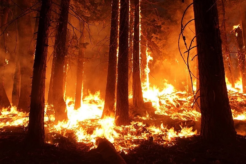
Adelaide-based Airborne Research Australia (ARA), which is a not-for-profit research institute that grew out of Flinders University, is creating free 3D high-resolution maps of the devastation caused by fires in the Adelaide Hills and Kangaroo Island.

Benefits

According to a recent press release, the maps will help communities recover and reduce future fire risks.

These will assist communities, emergency services agencies and researchers to plan recovery from South Australia’s summer infernos.

Moreover, these will help in better understanding fire behaviour and develop future fire defence strategies.

The founder and Chief Scientist of ARA, Flinders University Emeritus Professor Jorg Hacker, explained that high-resolution mapping data would help plan for community recovery and future fire prevention.

The data will be freely available to people in the research community in order for them to study and use it to obtain insights that will help communities better prepare against fires and to assist fire defenders to plan their strategies against these unprecedented fire events.

About the initiative

The maps contain unprecedented detail and are available on their website.

Data for these high-resolution maps are collected from low, slow flights by crewed motor gliders equipped with LIDAR, hyperspectral sensors and high-resolution RGB cameras.

LIDAR is a surveying system that uses light from a laser to measure the distance to a target by illuminating it with laser light and measuring the reflected light with a sensor.

Differences in laser return times and wavelengths can be used to make digital 3D maps of the target.

High-resolution RGB (Red Green Blue) cameras complement data from LIDAR and hyperspectral sensors to produce images with 6-8 cm pixel size over large areas of land.

It will then render this mapping data in three dimensions (3D) and animates it as fly-throughs to simplify viewing.

In many cases, remote sensing data taken from fire-affected areas disappear into a black hole. Thus, the general public either never sees it or sees only a down-sampled low-resolution version.

The aim is to make all this data available to the public, particularly those directly affected, in order to help them recover their landscape, more specifically their natural landscape.

The sensors can map in unprecedented detail landscape and forest features that are not visible with standard aerial photography or satellite data or from the ground.

The combination of LIDAR and hyperspectral sensors provides centimetre resolution detail, which allows for detection of the location of such habitats and the state and structure of the undergrowth with LIDAR as well as the state of health of the surviving vegetation with hyperspectral scanning.

Professor Hacker shared that their maps were much more detailed than commercial aerial surveys because most commercial cases fly high in order to get coverage of large areas.

Meanwhile, the company’s planes are derived from a glider, so they can fly low and slow, with minimal fuel usage.

Drones are not a viable option because they cannot carry the sensors being used and are limited in their range. The planes allow them to cover remote areas such as Kangaroo Island, flying from Adelaide.

PARTNER

Qlik’s vision is a data-literate world, where everyone can use data and analytics to improve decision-making and solve their most challenging problems. A private company, Qlik offers real-time data integration and analytics solutions, powered by Qlik Cloud, to close the gaps between data, insights and action. By transforming data into Active Intelligence, businesses can drive better decisions, improve revenue and profitability, and optimize customer relationships. Qlik serves more than 38,000 active customers in over 100 countries.

PARTNER

CTC Global Singapore, a premier end-to-end IT solutions provider, is a fully owned subsidiary of ITOCHU Techno-Solutions Corporation (CTC) and ITOCHU Corporation.

Since 1972, CTC has established itself as one of the country’s top IT solutions providers. With 50 years of experience, headed by an experienced management team and staffed by over 200 qualified IT professionals, we support organizations with integrated IT solutions expertise in Autonomous IT, Cyber Security, Digital Transformation, Enterprise Cloud Infrastructure, Workplace Modernization and Professional Services.

Well-known for our strengths in system integration and consultation, CTC Global proves to be the preferred IT outsourcing destination for organizations all over Singapore today.

PARTNER

Planview has one mission: to build the future of connected work. Our solutions enable organizations to connect the business from ideas to impact, empowering companies to accelerate the achievement of what matters most. Planview’s full spectrum of Portfolio Management and Work Management solutions creates an organizational focus on the strategic outcomes that matter and empowers teams to deliver their best work, no matter how they work. The comprehensive Planview platform and enterprise success model enables customers to deliver innovative, competitive products, services, and customer experiences. Headquartered in Austin, Texas, with locations around the world, Planview has more than 1,300 employees supporting 4,500 customers and 2.6 million users worldwide. For more information, visit www.planview.com.

SUPPORTING ORGANISATION

SIRIM is a premier industrial research and technology organisation in Malaysia, wholly-owned by the Minister​ of Finance Incorporated. With over forty years of experience and expertise, SIRIM is mandated as the machinery for research and technology development, and the national champion of quality. SIRIM has always played a major role in the development of the country’s private sector. By tapping into our expertise and knowledge base, we focus on developing new technologies and improvements in the manufacturing, technology and services sectors. We nurture Small Medium Enterprises (SME) growth with solutions for technology penetration and upgrading, making it an ideal technology partner for SMEs.

PARTNER

HashiCorp provides infrastructure automation software for multi-cloud environments, enabling enterprises to unlock a common cloud operating model to provision, secure, connect, and run any application on any infrastructure. HashiCorp tools allow organizations to deliver applications faster by helping enterprises transition from manual processes and ITIL practices to self-service automation and DevOps practices. 

PARTNER

IBM is a leading global hybrid cloud and AI, and business services provider. We help clients in more than 175 countries capitalize on insights from their data, streamline business processes, reduce costs and gain the competitive edge in their industries. Nearly 3,000 government and corporate entities in critical infrastructure areas such as financial services, telecommunications and healthcare rely on IBM’s hybrid cloud platform and Red Hat OpenShift to affect their digital transformations quickly, efficiently and securely. IBM’s breakthrough innovations in AI, quantum computing, industry-specific cloud solutions and business services deliver open and flexible options to our clients. All of this is backed by IBM’s legendary commitment to trust, transparency, responsibility, inclusivity and service.